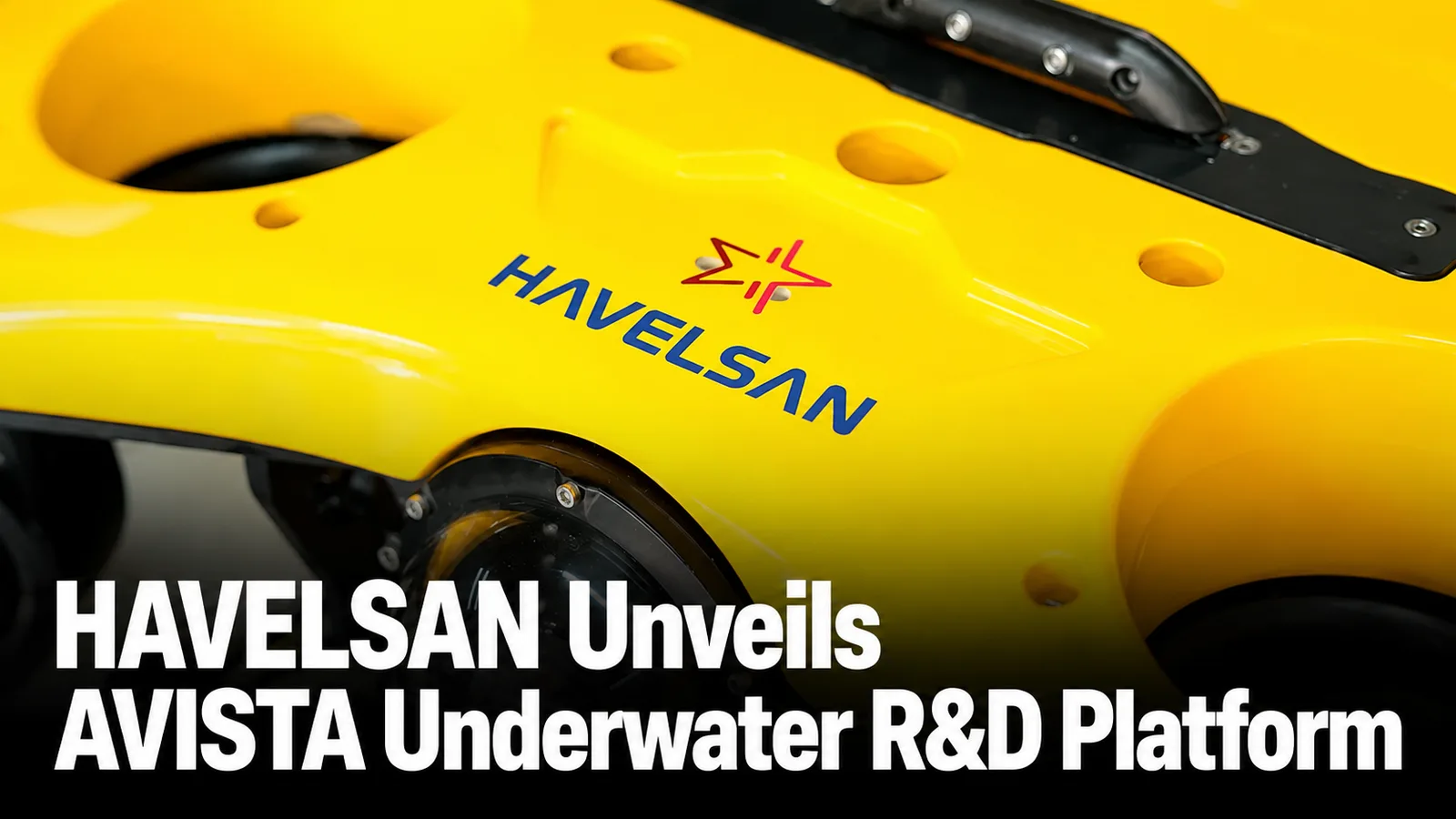
HAVELSAN AVISTA has made its public debut at TEKNOFEST Mavi Vatan 2026, introducing a new underwater research and development architecture focused on precision positioning without GNSS, three-dimensional underwater mapping, ship-hull inspection and autonomous navigation technologies.
Unlike a conventional unmanned underwater vehicle programme centred primarily on one production platform, AVISTA is being developed around platform-independent algorithms and software. HAVELSAN is currently using a six-degree-of-freedom remotely operated underwater vehicle as a development and test platform, with the intention of transferring the resulting capabilities to other underwater systems.
The programme matters because the technologies developed under AVISTA are intended to feed HAVELSAN’s wider naval autonomy architecture, including the submersible ÇAKA vehicle and potentially the ADVENT MÜREN combat-management environment for anti-submarine, mine, surface and seabed warfare.
Key Facts
- Public debut: TEKNOFEST Mavi Vatan, held at Gölcük Naval Shipyard Command from 20–23 August 2026.
- Developer: HAVELSAN.
- Programme status: Company-funded R&D project; not publicly identified as an inventory or serial-production system.
- Development platform: Six-degree-of-freedom remotely operated underwater vehicle.
- Core functions: GNSS-denied underwater positioning, 3D mapping, ship-hull inspection and navigation-corridor generation.
- Architecture: Platform-independent algorithms and software intended for integration with different underwater vehicles.
- Future integration: Technologies are intended to support ÇAKA and contribute to ADVENT/ADVENT MÜREN underwater warfare capabilities.
HAVELSAN AVISTA Makes Its Public Debut
Anadolu Agency reported on 19 August 2026 that HAVELSAN would unveil AVISTA for the first time during TEKNOFEST Mavi Vatan at Gölcük Naval Shipyard Command.
HAVELSAN subsequently confirmed through its official communications that the company-funded R&D project was being displayed publicly for the first time during the 20–23 August event.
The project expands HAVELSAN’s autonomous maritime work beyond existing surface systems such as SANCAR and into underwater navigation, mapping and inspection.
The terminology requires care, however. AVISTA is frequently described as an underwater vehicle because a physical ROV is being used to demonstrate and develop the system, but HAVELSAN’s disclosed programme architecture is broader than that individual platform.
AVISTA Is an R&D Architecture, Not Yet a Production UUV
AVISTA should not currently be presented as a fielded autonomous underwater vehicle or a Turkish Naval Forces inventory programme.
HAVELSAN describes it as an internally funded research and development project.
A six-degree-of-freedom remotely operated underwater vehicle is being used as the physical development and test platform while engineers build the positioning, perception, mapping and software layers.
The distinction is strategically significant because HAVELSAN wants those algorithms to remain independent of one specific hull.
If successful, the software and navigation architecture could be transferred to vehicles of different dimensions and mission classes without recreating the entire autonomy stack for every platform.
GNSS-Denied Positioning Is the Core Technical Problem
One of AVISTA’s principal objectives is reliable underwater positioning where conventional satellite-navigation signals are unavailable.
GNSS signals do not provide normal positioning once a vehicle is submerged, making underwater navigation fundamentally different from operating a UAV or surface vessel.
An underwater vehicle must instead combine information from onboard sensors, inertial navigation and other available positioning references to estimate its movement and location.
Errors can accumulate during longer submerged operations if those measurements are not corrected accurately.
HAVELSAN is therefore using AVISTA to develop an integrated underwater positioning capability capable of supporting navigation without continuous access to satellite positioning.
Three-Dimensional Underwater Mapping Adds a Second Layer
Positioning alone is insufficient for many autonomous underwater missions.
The vehicle also needs to build an understanding of the environment around it.
AVISTA is therefore being developed for three-dimensional underwater mapping, allowing sensor information to be converted into a spatial representation of underwater structures and terrain.
The capability has applications across naval operations, harbour security, infrastructure inspection and search-and-rescue missions.
For military systems, accurate mapping can also contribute to navigation through complex environments where reliance on pre-existing charts alone may be insufficient.
Ship-Hull Inspection Is One of the First Practical Missions
HAVELSAN identifies ship-hull inspection as another AVISTA capability.
Automating this task could reduce the requirement for divers to inspect large sections of a vessel manually and could allow a repeatable digital record of the underwater hull condition to be created.
Possible applications include maintenance inspection, detection of foreign objects and examination of underwater structures around naval bases and ports.
HAVELSAN has not published detailed detection thresholds, sensor resolution or inspection speeds for AVISTA.
Those parameters should therefore not be inferred from commercial underwater inspection systems or unrelated UUV programmes.
Navigation Corridor Generation Supports Autonomous Movement
Another disclosed function is navigation-corridor generation.
This capability connects perception with vehicle movement by using mapped information to identify a safe path through the underwater environment.
For future autonomous systems, that could allow a vehicle to navigate around underwater obstacles, infrastructure or seabed features without requiring an operator to manually control every movement.
The importance increases as HAVELSAN moves from tethered ROV experimentation toward more autonomous platforms in which communication with the operator may be intermittent.
HAVELSAN Is Targeting Lower-Cost Underwater Sensors
The economic rationale behind AVISTA is also unusual for a defence R&D programme.
HAVELSAN says high costs and customs-related procurement constraints associated with specialised underwater sensors contributed directly to the project’s creation.
The company is therefore exploring whether more readily available and comparatively affordable sensors can be combined with advanced algorithms to produce the required navigation and perception capability.
This effectively shifts part of the system’s value away from expensive specialist hardware and into software.
If successful, that model could make autonomous underwater functions easier to scale across several vehicle classes.
Software Is Intended to Be Platform Independent
Platform independence may become AVISTA’s most important industrial feature.
Rather than binding the developed algorithms permanently to the ROV currently used during testing, HAVELSAN intends the architecture to be portable to other underwater platforms.
This can reduce duplication across future autonomous programmes.
A common navigation, mapping and autonomy layer could potentially be adapted to inspection vehicles, mine-warfare systems, hybrid surface/subsurface vehicles or other UUVs.
The approach is consistent with HAVELSAN’s broader emphasis on software-defined defence architectures rather than treating every physical platform as an isolated system.
AVISTA Will Feed the ÇAKA Programme
The most direct military connection disclosed by HAVELSAN is ÇAKA.
HAVELSAN is developing ÇAKA as a submersible kamikaze unmanned surface vehicle capable of operating on and below the water.
The company currently lists ÇAKA at 8.5 metres long, 3.3 metres wide and approximately 3.6 tonnes displacement, with a manufacturer-stated surface speed exceeding 50 knots.
Because ÇAKA must navigate while submerged, reliable underwater positioning and perception become directly relevant to its development.
HAVELSAN therefore states that capabilities generated through AVISTA will provide technology infrastructure for the ÇAKA Hybrid Unmanned Marine Vehicle programme.
ÇAKA Is Approaching a More Mature Development Stage
HAVELSAN General Manager Mehmet Akif Nacar provided additional context during TEKNOFEST Mavi Vatan.
Nacar said on 21 August 2026 that the company was nearing completion of ÇAKA and expected its hybrid surface and underwater operation to become visible in the near future.
This makes AVISTA relevant to a programme already moving beyond the conceptual phase.
It also illustrates why HAVELSAN is investing in reusable underwater software capabilities rather than developing every navigation function exclusively inside ÇAKA.
ADVENT Integration Could Connect Underwater Autonomy to the Fleet
The second major integration objective is HAVELSAN’s ADVENT combat-management architecture.
ADVENT was developed as a network-supported combat management system capable of connecting multiple naval platforms into a common operational and command environment.
HAVELSAN’s long-term objective is for AVISTA-derived capabilities to operate in conjunction with ADVENT rather than remain isolated onboard one underwater vehicle.
That distinction can determine whether an autonomous vehicle becomes simply a survey robot or an integrated naval sensor node.
If underwater position, mapping or contact information can be transferred into a wider combat-management environment, it can potentially support decisions by other ships, submarines and command centres.
AVISTA Is Also Linked to ADVENT MÜREN
HAVELSAN specifically identifies ADVENT MÜREN as a future beneficiary of the project.
Nacar said AVISTA-derived technologies could contribute at different levels to anti-submarine warfare, surface warfare, mine warfare and seabed warfare functions within the submarine-oriented combat-management architecture.
This places the project within a much wider Turkish underwater warfare development programme rather than limiting it to harbour inspection.
Defence Agenda’s Autonomous Underwater Systems and Swarming Drones analysis examines how exactly this transition is changing naval operations: underwater vehicles are moving from standalone survey tools toward distributed sensing and mission nodes linked to wider command networks.
MİLDEN Gives the Software Architecture Strategic Relevance
ADVENT MÜREN is becoming especially relevant as Türkiye advances the MİLDEN national submarine programme.
Nacar said HAVELSAN aims to integrate AI-supported operational intelligence into MİLDEN and is positioning itself for a major role in integrating national sensors and weapons aboard the submarine.
This includes information-distribution infrastructure, steering-control research, submarine simulation and integration of indigenous weapons such as AKYA.
AVISTA is therefore a comparatively small R&D project inside a much larger digital-underwater architecture.
The algorithms developed on a six-degree-of-freedom ROV today could ultimately support different unmanned and crewed platforms if HAVELSAN succeeds in maintaining a common software framework.
Critical Undersea Infrastructure Is Another Target Mission
HAVELSAN also identifies critical underwater infrastructure protection as a major AVISTA application.
Submarine cables, energy infrastructure, pipelines, ports and naval facilities require inspection over large areas that are difficult to cover continuously with divers or crewed vessels.
An underwater vehicle capable of accurately positioning itself, mapping infrastructure and following repeatable inspection corridors can provide persistent inspection without exposing personnel to the same level of underwater risk.
The requirement has become increasingly important as NATO and other naval organisations treat seabed infrastructure as a distinct security domain.
Defence Agenda examines the operational implications in Threats to Undersea Infrastructure in Seabed Warfare.
AVISTA Has Civil and Public-Security Applications
Unlike many naval autonomous projects, AVISTA is not being framed exclusively around military use.
HAVELSAN identifies potential applications in underwater search and rescue, forensic investigation, infrastructure and energy-facility inspection and port security.
These missions rely on many of the same underlying technologies as military tasks: reliable positioning, repeatable navigation, environmental mapping and object inspection.
This dual-use potential could improve the economic case for further development because the software does not necessarily require a combat mission to generate operational value.
SANCAR Shows HAVELSAN’s Preferred Integration Model
HAVELSAN’s existing SANCAR programme provides an indication of how the company approaches autonomous naval integration.
SANCAR completed live-fire trials in September 2025 with its 12.7 mm stabilised weapon system integrated through ADVENT ROTA and the wider ADVENT Combat Management System.
HAVELSAN subsequently announced completion of acceptance testing and readiness for delivery.
The important precedent is architectural: the unmanned vehicle does not operate as a disconnected remote-control craft but as another platform inside a naval command-and-control system.
AVISTA is intended to extend that software-centric philosophy below the waterline.
The Underwater Domain Creates a Harder Networking Problem
Replicating the SANCAR approach underwater will be more difficult.
High-bandwidth radio-frequency communications that support surface and airborne autonomous systems do not propagate effectively through seawater.
Underwater networks therefore rely more heavily on acoustic communications, intermittent surfacing, tethered links or data exchange after a mission.
This places more responsibility on onboard autonomy.
A submerged vehicle may need to continue navigating, mapping and responding to obstacles for extended periods without receiving continuous instructions from a command centre.
AVISTA’s focus on local positioning and environmental understanding addresses precisely this problem.
Counterargument: Software Cannot Replace Sensor Physics
HAVELSAN’s lower-cost sensor strategy could reduce programme costs, but it also creates a technical trade-off.
Advanced algorithms can improve calibration, sensor fusion and interpretation, but they cannot remove the fundamental physical limitations of the underlying sensors.
Accuracy can still be influenced by water conditions, visibility, acoustic propagation, sensor noise, current, depth and the geometry of the inspected object.
The real value proposition therefore depends on whether HAVELSAN can achieve mission-acceptable performance with less expensive hardware rather than merely demonstrating that the algorithms function in controlled conditions.
No Public AVISTA Range, Depth or Endurance Figures Yet
HAVELSAN has not published a conventional specification sheet for AVISTA comparable with those available for production unmanned vehicles.
No confirmed maximum operating depth, endurance, range, vehicle dimensions, payload weight or underwater speed has been publicly released for the AVISTA development configuration.
Those omissions are consistent with the programme’s current R&D status.
Defence Agenda therefore does not assign technical specifications from the ROV test platform, ÇAKA or unrelated underwater vehicles to AVISTA.
Sea Trials Are the Next Immediate Milestone
HAVELSAN says sea trials are expected to begin in the near term.
Those tests will be considerably more important than the exhibition debut because they will begin validating positioning and mapping algorithms under real environmental conditions.
Successful sea testing would also allow HAVELSAN to examine how sensor performance changes with water conditions and whether the platform-independent software can maintain the required positional accuracy over longer missions.
No detailed sea-trial schedule or qualification programme has yet been publicly disclosed.
The 2027 Target Should Be Interpreted Carefully
Initial reporting states that HAVELSAN aims to make new underwater technologies and solutions available for use during 2027.
This should not be interpreted as a confirmed 2027 AVISTA inventory-entry date.
The wording refers broadly to the company’s underwater technology portfolio, which also includes ÇAKA and technologies supporting ADVENT MÜREN.
AVISTA itself remains an R&D project, and no procurement contract, customer quantity or formal service-entry schedule has been announced.
Implications / Next
The first milestone to watch is AVISTA’s initial sea-trial campaign. This will provide the first meaningful indication of how the GNSS-denied positioning and mapping architecture performs outside laboratory and controlled test conditions.
The second is platform transfer. Demonstrating the same algorithms on a different underwater vehicle would validate HAVELSAN’s claim that AVISTA is genuinely platform independent.
The third is ÇAKA integration. If AVISTA-derived positioning and navigation functions appear in the submersible hybrid vehicle, the R&D project will have achieved a direct transition into another operationally oriented programme.
The fourth is ADVENT connectivity. Passing underwater mapping, position or sensor information into ADVENT or ADVENT MÜREN would move AVISTA beyond local autonomy toward networked naval operations.
The fifth is sensor economics. HAVELSAN will need to prove that lower-cost and more accessible sensing hardware can deliver sufficient accuracy and reliability for military and critical-infrastructure missions.
Finally, any formal Turkish Naval Forces procurement or announced commercial customer would represent a substantially larger programme milestone than the current TEKNOFEST demonstration.
Conclusion
AVISTA is strategically interesting precisely because it is not simply another underwater vehicle.
HAVELSAN is using a six-degree-of-freedom ROV to develop a reusable software and algorithm architecture for GNSS-denied positioning, three-dimensional underwater mapping, ship-hull inspection and navigation-corridor generation.
If the architecture proves portable across platforms, its value could extend well beyond the current development vehicle.
ÇAKA provides the most immediate application, while ADVENT MÜREN creates a pathway into wider anti-submarine, mine and seabed warfare networks.
The programme nevertheless remains at the R&D stage. No inventory order, production quantity or operational qualification has been announced.
The next meaningful test will therefore occur in the water rather than on the exhibition floor, when HAVELSAN begins validating whether AVISTA’s software-centric approach can deliver accurate and affordable underwater autonomy under real maritime conditions.
Further Reading
- Anadolu Agency: HAVELSAN Introduces AVISTA Underwater R&D Project
- Anadolu Agency: HAVELSAN Links AVISTA, ÇAKA and ADVENT MÜREN
- HAVELSAN: ÇAKA Submersible Unmanned Surface Vehicle
- HAVELSAN: ADVENT Combat Management System
- HAVELSAN: SANCAR AUSV Completes Live-Fire Trials
- Defence Agenda: Autonomous Underwater Systems and Swarming Drones
- Defence Agenda: Threats to Undersea Infrastructure in Seabed Warfare
- Defence Agenda: HAVELSAN Unveils AI-Driven Defence Systems